Next weekend (Friday, November 22nd, 2019), if all goes well, a free for all public minibus service will start operating in the Gush Dan conurbation. The service will include the cities Tel Aviv — Jaffa, Givatayim, Ramat Hasharon, Holon and Kiryat Ono with six different circular lines in a frequency of twice an hour.
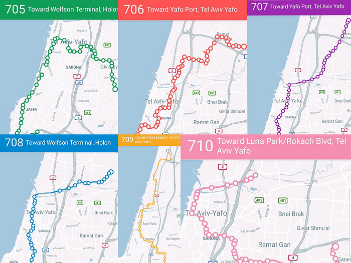
Static maps of the lines
Since all we got so far from the mayor’s deputy for transportation affairs, Meital Lehavi, are a bunch of static photos (her Facebook post about it) and a link to a proprietary iPhone/Android app called Bus Nearby, I thought I could display all the lines and their stops on a Google map to share it. So I did.